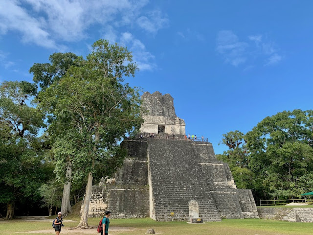
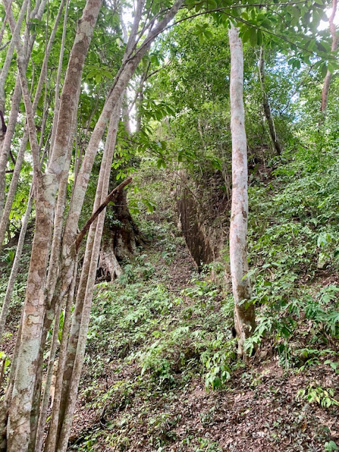
Tikal was the main motivation for the trip. Steve was here with Katie and Adam 15 years ago (following an OC confence where they helped with logistics.) He remembers the freedom to scramble as in Great Zimbabwe. It's still like that although we had a guide who gave us lots of information and time limits for our scrambling so we could move on the the next part of the park. We did NOT see everything.
The civilization flourished here from 300 BC to AD 900. We know a lot of specifics because of Mayan written records in inscriptions. They had a strong view of history, a highly developed calendar and dated all their monuments with birth and reign of kings.
We started with this scale model of the park which I include here to give you an idea of the extent. One of the ladies told me she had been expecting "a pyramid." The someone said something about wanting to climb pyramid 4 (foreground.) "You mean there are 4?" As you can see from the model there are a lot more than 4 buildings.

This temple, impressive as it is when you first enter the park, doesn't merit a name on the map except that it is part of Complex Q.
Below is Temple I. I was so excited that I took a bunch of pictures of the back of it before we ever came around to the front and the massive plaza that it faces.

Opposite Temple I is the smaller Temple II.
You can climb Temple II from the back on shallow wooden steps. "Shallow steps" is very important because climbing the tall steps to the Northern Acropolis just about killed my legs.
From the top of Temple II you an see Temples III and IV rising out of the jungle in the distance. (This was taken with telephoto; they are really further away than they look here.)
Temple II on the right, Temple I hidden by the trees on the left. I'm not sure which temple is straight ahead, but it's part of the Central Acropolis. This is taken from the North Acropolis with the really high steps. Someone told me that they weren't originally so high. What we climb on today is the inner structure. The actual steps were much lower, but they must have been terrifyingly steep. Hard to imagine taken them in full royal regalia.
Here we have the view from the Central Acropolis, with Temple 1 on the right. I didn't leave nearly enough time to explore the palaces on this side.
Temple III has only had its top exposed (behind the trees at the top). You can glimpse a bit of the side of the steps peeking out of the undergrowth that covers most of it. Remember, this whole city was lost for almost a thousand years, all Indiana Jones.
Many of the monuments are only partially exposed or completely covered in earth and greenery.
The Plaza of the Seven Temples, like Stonehenge, was designed to show the solstices and equinox and tell the Maya when to plant. The sun rose through these notches on certain days.
Temple IV is the tallest. We may be seniors, but a lot of us climbed the 187 steps--modern wooden ones against the jungle-covered sides of the pyramid.
The view from the top includes Temples I and II (close together to the left), Temple III and I think the Grand Pyramid off to the right with the point right at the top of the canopy.
There is a wide buffer zone around the park. I suspect that is to provide us with this uninterrupted view of the jungle from the tops of the pyramids. It would kind of spoil the feel to spot towns and hotels from up there.
Lunch was another open-air shelter. Delicious as usual. Two bottles of water per person to prevent dehydration.
I’m not a big souvenir buyer, but I have been fascinated with the Mayan writing system. On the wall leading to my office at home I have some parchment, some papyrus, a couple posters of illuminated manuscripts, and an Ethiopian story painted on cloth. I thought this replica of a page from the Dresden Codex would be a nice addition to my collection.


No comments:
Post a Comment