Sunday, September 23, 2018

Utah Day 13: On the road again

We were on the road by 7:10 this morning. The first three hours were beautiful--through the Colorado Mountains.


After that... Well, eastern Colorado and Nebraska don't merit a lot of photos.

We're back to Mom in the back so she can put her feet up. The walker is packed in the trunk so getting out involves taking an arm and less independence at rest stops. Now that we are at the hotel, everything comes out of the trunk including the walker. It is Sunday evening so supper is popcorn, apples and good Burnett Dairy cheese, as it would be at home.

Tomorrow we'll be up early and on the road. Should be an eight-hour trip home so Steve can hop back in the car and head for band practice. Mom and I will no doubt be sound asleep when he gets home.

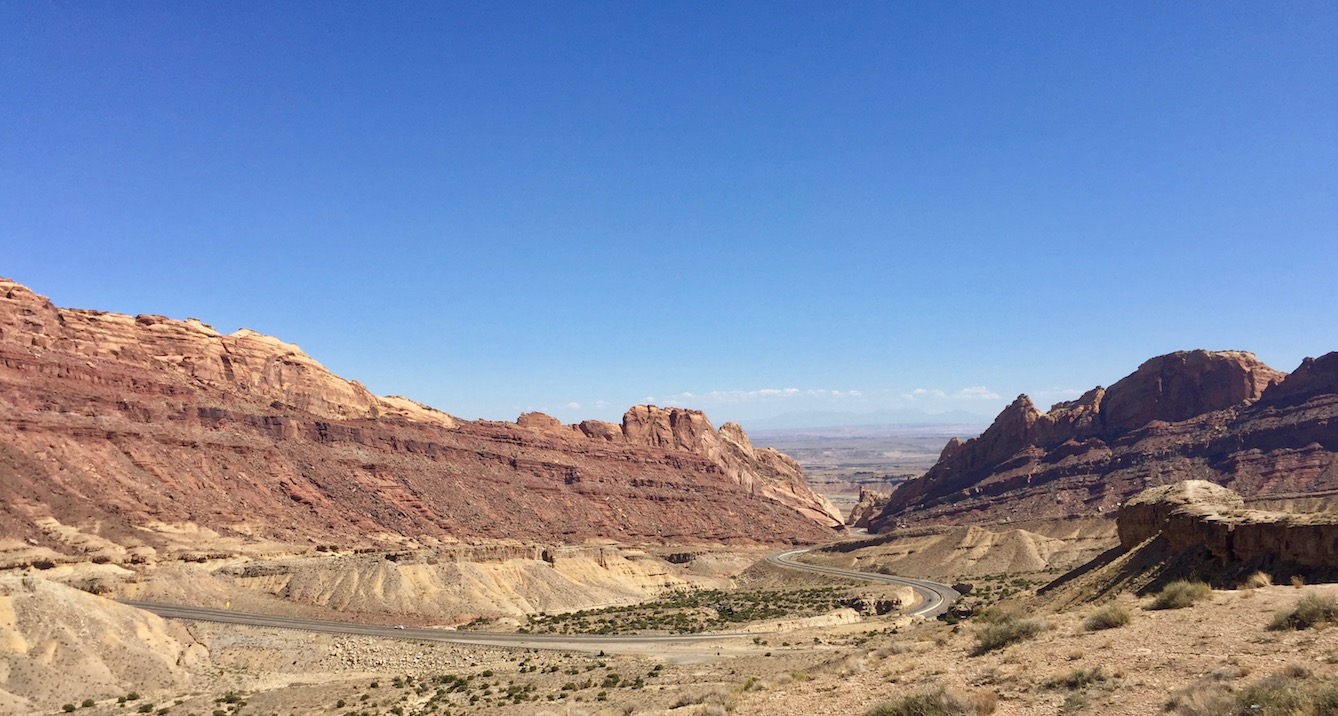
It's been a wonderful trip with almost more beauty than we could take in. My brain is already planning the Shutterfly book. Mom's highlights are sunset at Bryce Canyon and the hogback where canyons dropped away on either side of Rt. 12 (day 8). Steve's highlight was clinging to the cliff on the gravel Shafer Trail Rd. in Canyonlands (day 4). I loved sunset at Bryce and at Arches (days 8 and day 4), but I think my highlight was getting down among the hoodoos, hiking in the early morning at Bryce Canyon (day 9).

Mom has been a trouper, getting up way earlier than she usually does at home, eager for the sights of each new day. We are grateful for fabulous weather, good health for all three of us, and no car problems (except needing to add air to a tire a couple times, but considering some of the roads we were on, that's hardly surprising!)

Delightful as it has been, I am eager to get back to revisions of Glastonbury III and follow-up on rights for a non-fiction book in process. Also home-cooked food, my own bed, and not having to repack every morning.

Unless something unexpected happens, this will be my last post until Panama in October.

Day 14:
We finished the audiobook just north of the Twin Cities. (I highly recommend the whole series.) I found a North Dakota license plate somewhere in there. We ended the journey with 44 plates seen, missing West Virginia, Maryland, Rhode Island, Delaware, New Hampshire, and of course, Hawaii. You almost have to be on a military base to find a Hawaii plate. I saw Alaska twice. Does that count? For the record, national park parking lots are great places to hunt.


Saturday, September 22, 2018

Utah Day 12: Headed Home

This morning we started the long trek home. That doesn't mean leaving behind the beauty. All of I-15 and I-70 are marked as scenic on the Utah road map. Besides, you know us. We took a detour.

We left the rolling hills of I-15 at Cedar City and headed up Rt. 14 into a beautiful canyon, but sorry, no convenient places to stop for photos. We did stop at the top and look back toward Zion. I don't usually like dead trees in my pictures, but this one has a hawk in it.


We turned north at Rt 148 where we turned the other day coming from the other direction and retraced our route through Cedar Breaks National Monument. This time we stopped at the visitor center and took in the overlook.


I ran into a couple who were so pleased to have just purchased their lifetime pass for national parks. We bought ours several years ago when the cost was $10 for seniors over age 62. The price has now gone up to $20 for an annual pass or $80 for lifetime. "It's a worthy cause," the man told me. I agree. And we have used ours in 7 places this trip alone. At $35 for most of those parks, even $80 is a bargain.

We continued north on Rt. 143 where we had turned east before. Steep winding roads with high snow poles marking the road for winter. The area was devastated by the pine beetle. Brian Head is a ski area, and there we saw whole hillsides of dead trees being logged.

At Parowan we continued north on I-15. It felt really weird to be going so fast (speed limit 80) on a wide divided highway.

Even the rest stops on I-70 have stupendous views.

Another stop. That's the interstate down there passing through a gap where workers could touch both sides when they started construction in 1970.


My dad wondered why there were never any houses in my pictures. I think he was wondering if anyone actually LIVES in Utah. Yes, they do, but not in the national parks. Dad, here's the view from our hotel window this morning. Note the houses of La Verkin, Utah.


Tonight we're back in the Best Western in Grand Junction, CO. Got a buclet of KFC and ate it in the shady courtyard outside our room with a can of corn and another of German potato salad. Very pleasant. Tomorrow we leave behind the mountains.

Friday, September 21, 2018

Utah Day 11: Boots on the ground in Zion

Best birthday present ever! Steve dropped me off at the shuttle a little before 7.


I rode up to the top of Zion Canyon and walked the very tame, but very beautiful Riverside Trail.


Breakfast spot.


I SHOULD have taken a change of shoes. Many walkers headed up the Narrows wading in the creek. I had the impression that it was all (10-12 hours with equipment from an outfitter) or nothing. I'll have to come back. (In fact, Steve gave me a book of hikes in Bryce and Zion as a more concrete birthday gift.)


The plan was to meet up at the Visitor Center at 11:30, so I had time to fit in a couple more easy walks. This one was to Lower Emerald Pool.


When I got there the pool was small, but the water coming over the rocks sparkled in the sun.


I saw deer a couple times, but they tend to stay in the grass and shadows and don't come out for photos. But this guy did.


I was glad someone else put his hand near to show the size and I didn't need to.

One more quick hop off the shuttle to climb to the Patriarchs overlook. Beginning in the middle of this panorama shot, that's Abraham, Isaac and Moroni there with Jacob peaking over Moroni's shoulder.


I know. Moroni isn't in my Bible either. The Mormon's named the peaks.

After yummy crepes in a local cafe, we took the road to Kolob Reservoir. It goes in and out of the park past a variety of trail heads, but is MUCH less crowded than Zion Canyon itself. We passed a house with this view. Can you imagine what they must have paid for the lot?


The asphalt ended at the reservoir.


Water level is down a bit. I'd be happy to contribute some of our lake water that currently completely drowns our beach.


This is our last national park for this trip. Tomorrow we start home--by the scenic route, of course--up I-15 to I-70. No more hiking, but maybe I'll convince Steve to stop at a few scenic pull offs.

Thursday, September 20, 2018

Utah Day 10: Rt. 89

At breakfast in our hotel we heard Korean and German. In the park we heard lots of French as well. If you are a foreigner visiting the US, this is a great part of the country to visit.

After breakfast we took off west on 12 back along the north edge of the park. It was cold--37--but it didn't stay there.

You don't have to be in a park to see beautiful scenery around here.

We turned south on Rt. 89, but the Hardys never go anywhere in a straight line if there is a scenic route nearby. We turned west on Rt 14 at Long Valley Jct. (a gas station). We made a loop north on Rt. 148, back east on Rt. 143, and south again on Bicycle Rt. 70 to return to Rt 14 and 89. We've seen a lot of bicycling around here. Definitely not the kind of up and down I would choose. The other day coming over Boulder Mountain on Rt. 12 we saw a whole group of bicyclists. Apparently a tour group. Probably with someone taking their stuff to the next stop. But near the bottom of the mountain we came upon a man pushing his bike. He had miles of uphill ahead of him. He must have been REALLY wondering what he got himself into.

Our loop was mountain country similar to what we saw on Rt. 12 over Boulder Mountain. We came upon an area of resorts, but I suspect they were places where Utah people go for a get-away, not foreign tourists, since there was nothing unique about them. It wasn't as scenic as it might have been since in places there were more dead trees than live. One entire mountainside seemed to be nothing but dead trees--a forest fire waiting to happen as Steve said. I suspect the cause is the pine beetle that has been devastating western forests.

The other interesting thing we saw was rocks--piles and piles of them in a ring around a mountain. There was a sign for a "cinder cone," so we figure a long-ago volcanic explosion.

Turning back south on Rt. 89, we hit the first road construction we have seen the whole trip. One way traffic, but not a big delay.

Coming west on Rt. 9, we pass through a 1.1-mile-long tunnel to enter Zion Canyon. We had to wait our turn. It's a one-way tunnel so the buses (which are considerably larger than when the tunnel was built in 1930) can go down the middle

The tunnel is unlit. Signs remind you to turn on your lights and take off your sunglasses. There are a few windows that open onto the canyon.

On the far side are a series of switchbacks down into the valley.

From one of the switchbacks, we could see one of the tunnel windows on the cliff face above.

Lunch was in front of the shopping area outside the Zion National Park Visitor Center.

Steve went to the bathroom before lunch. After lunch we stopped at the information booth. While we were asking questions, someone came up with his wallet saying, "Someone left this in the bathroom." Steve Hardy's guardian angel to the rescue again. It had probably been half an hour, but all money and credit cards were there.

Due to the crowds, cars aren't allowed up the Zion Canyon Scenic Drive. You have to take a shuttle. Even the shuttle parking lots were full, with instructions to park in the town of Springdale and take a free city shuttle to get the free park shuttle. We were concerned about Mom getting on and off a bus and were able to get a special permit to drive in but not stop. At least Mom could oggle the views.


Supper at China Buffet in Hurricane. Nice change. (How on earth does a town in the middle of the desert get the name of 'Hurricane'?)


Wednesday, September 19, 2018

Utah Day 9: Bryce Canyon, up close and personal

The shuttle doesn't start runnng until 8PM so Steve took me into the park and dropped me off before sunrise. I was well before the hour, but if I had been much later, I would not have gotten a place along the rail. I was glad for my jacket in the pre-dawn chill. Clouds obscured the sunrise, which is great when your goal is to see the golden ring around them, but not so nice when you want the early rays hitting the rocks. The light was filitered, but not bad.


I started down Queen's Garden Trail. I wasn't the only one, but most of the crowd headed back to their hotels or campsites for breakfast. I had packed granola bars, a fruit cup, and a thermos of tea, and sat on a log part way down, waiting for the sun to rise above the clouds. Eventually the sun came out, and although I was low down in the valley, the views were breath-taking.


A few places they had cut doorways to ease the trail along. Yesterday while Mom sat at Sunset Point she watched people appear and disappear along this path.


I did a lot of looking straight up.


I took the connecting path to Navajo Loop Trail and came up "Wall Street."


The stairs turned to switchbacks. This is the view I saw last evening that made me determine to do this trail. Steve took one look and said, "No, thanks." (Note the switchbacks down to the dark opening between Hoodoos.)


The light could no longer be called "early morning" (it was a little past 9), but it was still spectacular.


Steve and Mom were enjoying a rerun of the incredible road we came down yesterday. I was scheduled to meet them at Inspiration Point at 11:30, so I followed the Rim Trail. Getting to Inspiration Point well before the meeting time, I continued toward Brye Point Overlook. Didn't go that far, but here is a glimpse of the narrow trail along a spectacular hogback just south of Inspiration Point.


Conclusion: I wanna hike every trail in this park!


Utah Day 8: Bryce Canyon from the rim

We arrived in Tropic with plenty of time to do a quick survey of Bryce Canyon. Wow! We parked Mom at the overlook at Sunset Point and hiked over to Sunrise Point.

Unfortunately, I had my phone in airplane mode because we had been out of range so much. It didn't occur to me that that turned off the GPS. So I can't tell you for sure which view is from which overlook. Suffice it to say, they were all fabulous.


Mom went out at Sunset Point and Bryce Point, but Inspiration Point was too steep.  We highly recommend parking at the entrance and taking the shuttle unless you have mobility problems. It lets you on and off and you can easily hike from one point to the next.

Tuesday, September 18, 2018

Utah Day 8: Rt. 12

Steve invariably wakes before Mom or I. Lately we have stayed in motels without lobbies for him to go to, so this is what I see when I open my eyes.


The plan for the day was Rt. 12 From Torrey south to Tropic outside Bryce Canyon National Park, but we started with a side trip going further on Rt. 24 that we traveled yesterday. I stopped to shoot the old Mormon church on our way out of town.


There has been a lot of historical stuff around, but we have been more interested in nature. We turned N on Rt. 72 to Fremont and then cut off to Fish Lake National Forest. Well worth it. So different from anything we have seen so far. Mom spotted 5 deer on the hill above this meadow.

Back on 24, we headed east and then south toward Teasdale (lots of gorgeous houses on mulitacre lots) then south on Rt 12. We retraced our steps over Boulder Mountain, then headed into new territory. The Hogback through Escalante Canyons was definitely the highlight. That's canyons dropping away on both sides of the road in this picture. In places it was a 14% grade. But at least it was asphalt


The road up the far side was less stark, but also gorgeous. Sadly, the cafe you can see in the valley is closed on Tuesdays or we would definitely have stopped there for lunch.


We reached Tropic in time to drive into the park and do the scenic drive. Mom thought she had been here when Patty taught in NM, but it didn't look familiar to her. We're pretty sure if she had seen it before, she would remember. I took lots of pictures, but I will save most of them for tomorrow which is officially Bryce Canyon day (although Steve and Mom are talking about retracing today's Rt. 12 while I hike in the morning.) Here's just a teaser.


Monday, September 17, 2018

Utah Day 7: Capitol Reef Naitonal Park

Wonderful day in Capitol Reef National Park. Mom and Steve dropped me at the bottom of Grand Wash at 8:45 with a promise to meet at the parking lot at 11. They drove the scenic drive down into Capitol Gorge while I hiked up the wash.


I reached the turn off for Cassidy Arch (almost at the parking lot) at 9:40. Darned if I was going to sit in the parking lot for an hour and twenty minutes. The wash trail was easy--up hill but the incline was slight the whole way. Cassidy Arch Trail is 'strenuous'. 'Strenuous' by American standards (rather than Korean) includes steps carved into the rock. No need to pull myself up by chains. 


Steve and Mom picked me up at the end of Grand Wash Road and we followed the ranger's suggestion of making the loop to the south. Leaving ghe park, we followed Notham Road. Eventually it becomes gravel, but high quality, and the ranger assured us that we didn't need four-wheel drive since it hadn't been raining. 

We drove between two reefs of ancient rock as different as nitght and day. Eventually the road went into the park, climbed a bit and we stopped for lunch at the Cedar Mesa Campsite. I was hoping for a little shade, but we even found a picnic table in the shade. No campers around to be bothered. Here is a picture back up the way we had come from the campground.

The road continued south along Sandy Creek, then crossed a divide and we found we were following Halls Creek before turning off to the Burr Trail Switchbacks you can see in the red triangle in the distance. Fabulous views, of course and no stopping for pictures on the steep incline.


We dropped Mom and the hotel in Torrey for a nap and Steve took me back to some of what they had seen while I was hiking, namely Sunset Point, where a 1/3 mile trail takes you out to an overlook facing east.


There were a couple benches, and I decided to return after our steak dinner at Broken Spur Inn and Restaurant where we were staying. I wasn't the only one to enjoy the sunset, although several people seemed confused as to where they were supposed to look, being accustomed to look west to the setting sun.