Wednesday, September 21, 2022

Glacier Day 2

Yesterday, between "Thank you, God," "You are incredible, Lord!"  and "How excellent is thy name in all the earth!" I may have mentioned to the Lord that today is my birthday and how nice it would be to have sunshine for the morning while I hiked.

It was a gorgeous, cloudless morning. He doesn't always answer yes to my prayers, but this one he did.

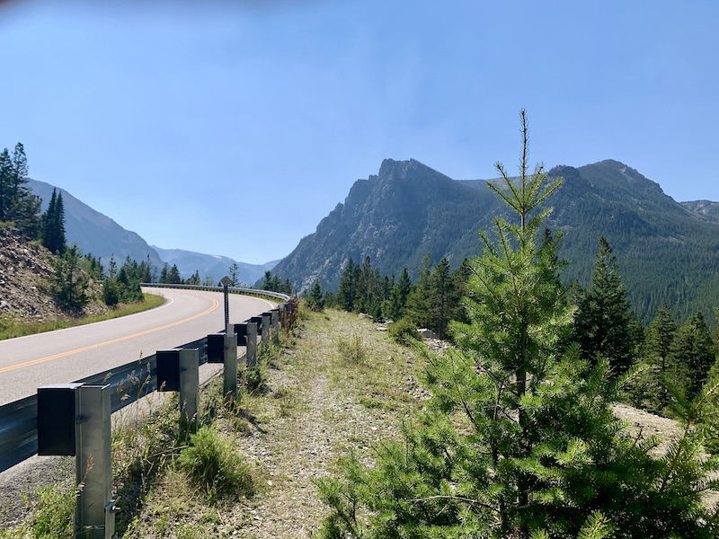
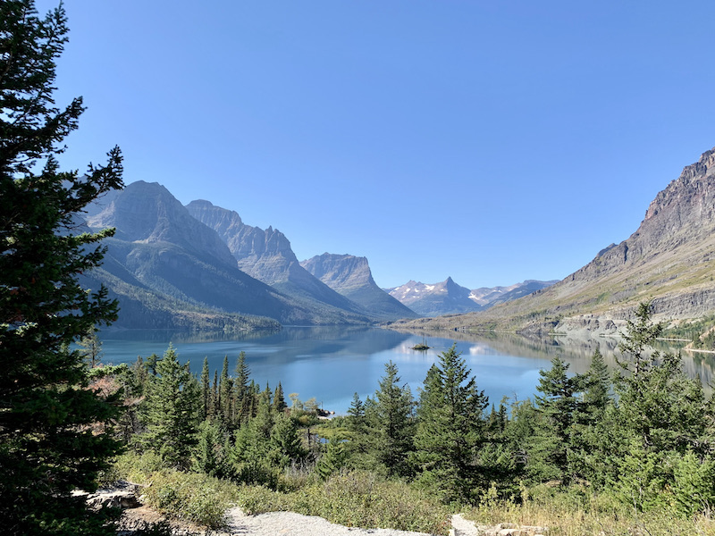
I learned my lesson yesterday. I went straight to Logan Pass without stopping. Well, almost without stopping. I couldn't resist a couple pullouts to take pictures of the rising sun on views that had been overcast yesterday. 

But no short hikes or waterfalls. I was very much aware that every car that passed me would be looking for a parking space at Logan's Pass. I pulled into the parking lot at 8:45 and took the last space I saw. (There might have been one or two others; I didn't go up every lane; but I didn't see any more.) The queue for the chemical toilets was even longer than yesterday. Everyone, like me, wanted to use them before setting off. I climbed a mile and a half to Hidden Lake Overlook. 

I stopped frequently "to enjoy the scenery." After all, I was back at 7200'. The music going through my head constantly was "Climb Every Mountain / Search high and low / Follow every byway / every path you know."


I did not hike the extra mile and a half to the lake itself since that would have been mostly steeply downhill, and what goes down, must come up. But the view from the top was worth it.

For that matter, the view in every direction was worth it. Besides the path back to the visitor center, you can see the road east off to the right.

Picnic spot. I was thinking that I had a four-hour drive after I left the park. If I had realized it was only two and a half, I would have lingered more.

I kept telling myself, "This is the last picture." This one really was. Wild Goose Island.

I am in Great Falls, MT, tonight. Then I have three long days of driving to reach Indianapolis for my father's 100th birthday. Unless there are more adventures than I am praying for, I don't expect to post anything more here. It has been a lovely couple days at Glacier. We will definitely be back. Wonderful time exploring and with family before that.

Now I think I will go eat one of the chocolate covered cherries my husband wrapped up for me as a birthday gift.

P.S. Almost forgot one last adventure. When I got back to the parking lot about 11:30, it was jammed with cars, circling round and round hoping for someone to leave. I was happy to oblige them, only my keys were not in my pocket. They weren't in my other pockets either. They weren't in the pocket of the jacket I had stuffed in my backpack when I got warm exercising (even though there was ice on the puddles.) Or anyplace else in my pack. I was sure I had put the keys in my back pocket. I will never do that again. They will be clipped to the string in my backpack where they can't possibly fall out. I dreaded climbing all the way back to the overlook, searching the ground for keys. Besides, wouldn't I have seen them on my way down? The only other place was... the toilets? I walked back up to the visitor center (while cars circled below like vultures waiting for my parking space) and asked if they had a lost and found. "What did you lose? Car keys? Did they have a little white plastic tag attached?" Oh, the relief!

There was a car waiting in front of my spot when I got there. I think he thought he had won the lottery when I said, yes, I'm leaving. His wife had to get out and stand there to keep someone else from swooping in as I pulled out.

I'm just really glad the keys hadn't fallen IN the chemical toilet.

Tuesday, September 20, 2022

Glacier National Park

 I had this idea that I would spend today working my way up this side of the pass, and tomorrow pick up where I left off and continue over the top. Bad idea.

I had a lovely hike on the Rocky Point Trail on the west side of MacDonald Lake. No people. Great views even if it was cloudy.


The trail is level along the lake for quite a while, then climbs at the point, although I think it would be easy enough to stay on the lake level and return the way you came. The back side of the loop has a lot more climbing. (But only about 4200'!)

The problem was that I started Going to the Sun Road late enough that every pull over was full until the hairpin turn called "The Loop" half way up the mountain. Better idea would have been to leave my lakeside hike for afternoon.

The climb to Logan's Pass was pretty overcast.


And when I reached the top there was fresh snow.

But no parking places. So after parking at an overlook and hiking maybe a quarter mile back to use the port-a-potty, I started my return journey.

I found a parking space at the Loop and did a three-mile hike from there. It started out cloudy, but then the sun came out. I stripped off jacket and sweater and hiked in short sleeves. At this altitude the fall colors are showing.

And with the sun out, every direction I pointed my camera was an irresistible shot.


People were so friendly. "Isn't it incredible?" "Have you been to Logan Pass yet?" "Just up here you'll have a great view of snow on the mountain. And go a little further and there's another one!"

I had fun shooting through the "windows" of a tunnel.

By mid afternoon the pullovers were emptying out, and it was easy to find a spot to park. This little waterfall is at Red Rock.

I wasn't the only one resting in the sun on the rock and enjoying the view. Well, I guess not everyone was enjoying the view. More than one had their eyes closed.

There were parking spaces at the Avalanche area in the afternoon, and I took a few minutes to do the <1-mile Trail of Cedars. Much of it is a raised boardwalk, I presume to protect the roots of the awesome trees.

Steve would have loved it. The road tops even Beartooth Pass above Yellowstone. The only negative is that everyone else wants to see it too. I guess we'll just have to come back.

Tomorrow's plan is to go straight to Logan Pass and then work my way down the other side. I have to be in Great Falls, MT, by nightfall.


Monday, September 19, 2022

Friends and Family

 The past week has been friends and family time. We first visited friends who are involved in a ministry called Sanctuary Inn, that receives hurting missionaries in community. It is a lovely little lodge near Mt. Hood.


Our friends' daughters were excited to show us the playhouse Daddy built.

We also visited our old friends Mark and Helen Downing whom we have known since Ethiopia in the mid-'70s and who lived in our house in Camp Grande after we had moved to Mozambique. But we were so busy talking and eating Ethiopian food that I never thought to take a picture until we were gone.

Next stop was Puyallap, WA, for the wedding of Steve's nephew Adam, days crowded with get togethers for the out of town guests.  Relatives were not the only ones whose relationships go back decades.The Hardy cousins who were able to be there took a picture with their grandma who just turned 97.

My daughter tells me this is not the kids' table. It's the cousins table from both sides.

While everyone was sleeping or watching football Sunday afternoon, I ran off and hiked at Swan Creek Park. The trail along the creek had lots of ups and down, but, funny thing, ups and downs at 3200' are an awful lot easier than at 75-7900'.

This morning I dropped Steve at the Seattle/Tacoma airport for the first leg of his journey to Angola. He will be teaching seminary classes and a conference for educators as well as meeting with students he has been mentoring in various ways. I had a long day of driving through mountains and across plains to Kalispell, MT, gateway to Glacier National Park. We tried to get here a couple years ago and couldn't get in. This time I am alone, but it is how I chose to break up my return journey east. I have no doubt we will come back someday with Steve,  but it doesn't hurt to check it out first.

Monday, September 12, 2022

One last hike on the TRT

 When we arrived on Thursday, I signed up for the guided hike this morning. (They happen M, W, Th mornings.) I didn't cancel even though I figured it would be the same trail I was on yesterday afternoon. As expected, Jeff (the guide) had lots of stories to tell about bears and forest fires. He showed us a burned over area from maybe twenty years ago that came very close to the hotel very quickly. They had two hours to evacuate. Some of the guests didn't want to go. The story is that the police asked for the name of their dentists, and they changed their minds.


Air quality was ify. I found a website that said it was 175 before I left the room. That dropped a bit before we left the meeting area, but was still enough that one guy with asthma turned back before we had gone far. Mostly we had a good walk, but you should be able to see the lake in this picture and mountains on the other side.

Jeff was surprised when I told him about the helicopters yesterday. "So they were working on Sunday?" But then he realized, they have to finish before the snow comes. They had made a lot of progress . A whole string of these poles went up that weren't there yesterday.

About the time I got back to the room, the wind must have shifted. Visibility went way down. Our reservation was through tomorrow, but we had found that we had a 10.5 hr drive to get to our Tuesday destination of Sanctuary Inn, a missionary retreat center in Oregon. Given the conditions here around Tahoe, we decided to leave a day early. So we had lunch and finished packing up. We saw no more (perhaps less) on the Kingsbury Grade going east than we did when we came in on Thursday. Later on the highway near Carson City visibility dropped even further. The air quality app I found said "254" which is hazardous, but I can't imagine it wasn't higher than that when we could hardly see the vehicles in front of us.

A little less than three hours north, we are staying in Susanville, CA, a town in the wilderness whose economy is no less than three prisons. No hiking. Skies were clear when we arrived, but then clouded up. Rain not smoke. Way better.

Sunday, September 11, 2022

Return to Castle Rock

 Yes! Blue skies this morning. There was still forest fire haze in the valleys, but beautiful here on the ridge. Yesterday I was excited to take Steve to Castle Rock. He was reluctant because of the up and down parts. He suggested we try the trail that takes off from the end of our hotel property. We figured since we were already on top the ridge, there wouldn't be as much climbing. 

Then he saw the pictures. 

This morning he was all for returning to Castle Rock. So after attending our daughter's church in San Antonio via the Internet, we took off for the Kingsbury North Trailhead.

The nice thing about hiking here as opposed to the trails at home is that here there is always a rock or log handy when you need to pause "to enjoy the scenery." We did a lot of enjoying the scenery. The blue skies were exhilarating. Blue in any shade is my favorite color, but a brilliant blue sky tops them all.

Look at the blue stuff hanging over Castle Rock. Haze still hid the lake, but we could see the mountains on the other side.


Met some other hikers who pointed out that it was possible to climb up this crevice and get on top this outcropping.

Here's the view from on top.


I took this picture for my Wisconsin friends. I think it would be a long hike to Spooner from here.

We came back to the hotel for lunch. Steve settled down for the football game and I took off for the trail that takes off from the top of the property. I surprised four deer but two disappeared before I could get my camera out. These two were less concerned.


I had barely reached the Tahoe Rim Trail when I noticed how much noisier it was than this morning. It sounded like helicopters. Stupid tours, I thought. But then, it is the weekend. Maybe during the week it isn't this bad.

The trail was mostly contour as hoped. It crossed a ski slope. The helicopters got louder. I could see construction vehicles on an access road below me. Then I got to a place where there was lots of orange tape and what would have been a flagman if this were a road instead of a trail. He held me back while a helicopter went overhead. It wasn't tours at all. They are building a new ski lift and the helicopters are ferrying the pieces to the top.

You can see in this picture that the sky is no longer blue. I began to taste smoke. A couple hundred yards past the "flagman" my eyes started feeling gritty. Hiking in this is no fun. I turned around to go back to the hotel. The flagman told me in the last couple minutes the Air Quality Index had gone from 100 to over 300--into the hazardous for your health range even if you don't have a prior condition. He had put on an K95 mask. Yeah. Good idea to turn back.

Saturday, September 10, 2022

Tahoe Rim

Steve had work to do, so I went off exploring on my own. Yesterday we passed a sign not far down the west side of the ridge we are staying on that said, "Kingsbury North Trailhead." So that is where I headed. I followed that road a long way to its end, past lots of houses that were no more fancy than our own at home, although they may cost a lot more due to the location. When I arrived about 9, I only saw one other car in the parking lot. (By the time I left, it was full and I had met several hikers along the way.) As I shouldered my pack with tea, ice water and lunch, a man came walking down the road and turned into the trailhead.

"Do you know the area?" I asked.

"Very well," he replied. So I asked for suggestions.

He recommended a loop to the right that would take me past Castle Rock. "Although if you go left, there is a very nice vista point not too far along." He warned me that the peregrine falcons were nesting at Castle Rock so I shouldn't go there, but I like a loop trail more than retracing my steps, so I went right while he went left.


It was beautiful even if the skies are still hazy with smoke.

When I got to the Castle Rock turn off, the sign said nesting season is done and it was OK to go there. I took the hiking trail. NOT this one.

The vista was awesome. although I think without the smoke I would have been able to see the lake from here.

I did some clambering around among the rocks, but nothing stupid. After all, I was hiking alone and didn't know how long it might be before someone came along to rescue me if I got in trouble.

I backtracked to the main trail and continued on around the loop. Given the altitude of 7500' to just over 7900', I frequently used Katies' technique of pausing "to admire the scenery." Believe me, there was plenty of scenery to admire. Despite the 90s and low 100s temps we have had most of this trip, here in the mountains it was cool and breezy.

I touched on the Tahoe Rim Trail before cutting back to the trailhead parking lot. It was only noon, and I had brought lunch, so I took off to the left for the vista the fellow had recommended. I found a nice spot to perch on some rocks and eat my apple, granola bar, carrots and hard boiled egg with a (hazy) view of the valley. About 10 minutes farther on, I found the place marked "Vista." I got a different perspective on Castle Rock from there.


This would be a great place to view the falcons when they are nesting.

It was 12:30 when I left the vista. I told myself 1 PM would be a good time to turn back. In fact, by that time, the trail was heading pretty much downhill. What goes down must come back up. At least, when the car is back at the parking lot. But before I retraced my steps, I found a place where I could prove there really is a lake out there!


By the time I got back to the trailhead, I had hiked 6 miles in 4 1/2 hours. (Lots of enjoying the scenery.) Tahoe Rim Trail goes all the way around the lake with lots of side trails like the ones I was on today. I told Steve I could come back every year and never get bored!

Friday, September 9, 2022

Lake Tahoe

Gorgeous area. I remember coming over the hill on the Interstate years ago and literally gasping at the beauty when I saw it. Ever since, I have wanted to come back. The Mosquito Fire is still raging 90 miles west of here. To say it affects our air quality and visibility is a major understatement, but there is still undeniable beauty.

The hotel pool guy was vacuuming ash off the bottom of the pool when I came up to investigate this morning. (Access is from the 6th floor of our building.)


He's from Michigan and misses the climate of the Midwest. Also pasties from the UP.

We started the morning thinking we would just hang out at the hotel after the days of heavy driving we have had, but then the sun came out. Sort of.

We did the drive around the lake. Our book said three hours, but that refers to driving time, not including stops. We took five. We could have spent more time if we had a California State Park sticker or the mountains were not obscured by smoke.

We filled up with gas in South Lake Tahoe at $5.49/gallon, the cheapest we saw all day. How about $6.59?

We hiked through the pines down to the beach from the National Forest Visitor Center west of South Lake Tahoe (a busy tourist town we couldn't wait to get out of). Signage wasn't great and we wandered well out of our way, but the paths were all level. No cliffs to climb.


We had taken a picnic, but picnic spots were sparse without paying for one of the state parks. So lunch was at a lovely little place on the beach that decided to close before we got our food. They did go ahead and serve us, but with the smoke only one other table was occupied.

Along the route we passed multi-million-dollar home after multi-million-dollar home. Many of them had garages on the third floor or higher. The rest of the house clung in layers to the cliff below the road. All had lots of windows to wash and enormous decks. 

Here are some homes to drool over. Mostly I wouldn't want to clean them. But I would love to sit on the deck and drink tea.

We stopped at Inspiration Point overlooking Emerald Bay with the only island in the lake. A tea house on top was built in 1929 by the woman who built the fake Scandinavian castle on the shore (not pictured). It is reached only by boat or a hike down the cliff (and back up, of course) that we didn't take although the trailhead parking lot was full, so evidently others do.

Despite the smoke obscuring the views, it was a beautiful drive. We'll have to return and do it again with blue skies. Maybe with snow.


Thursday, September 8, 2022

Layton, UT, to Stateline, NV (that is, Lake Tahoe)

 Today was a nine-hour-drive day.  Lots of time for knitting in the car.

The route alternated long, straight flat stretches of desert with climbs up and over mountain ridges. The most impressive flat stretch was the Bonneville salt flats--miles and miles of flat, white salt.


It reminded us very much of a thin layer of snow on a frozen lake, even to the point of car tracks left in the "snow." 

We took NV395 south from Reno. Steve was complaining that we had left the mountains behind. It was pretty hazy--a haze that turned out to be smoke from the Mosquito Fire in California, not humidity. When we turned west toward Tahoe Ridge Resort, we hadn't left the mountains at all. We were following a ridge that was completely hidden in the smoke. The climb to the top was pretty cool even if we couldn't see any views of the valley. Here is the view from our balcony.

They tell us it will probably be better in the morning. All I can say is, it's not as cold as Iceland.

Wednesday, September 7, 2022

Boseman, MT to Layton, UT

Today we headed south for a couple of the scenic byways in our National Geographic book. Mesa Falls Scenic Byway was well marked. We went in from Ashland at the south end and skipped the 12 miles of heavily logged forest at the north end. The beginning--across Montana wheat fields--was less than inspiring, but then the road plunged down into a wooded canyon of the Warm River and up the other side. Great view from the overlook.

Lower Mesa Falls required more of a hike to get close than we had time for. Worth going back. Upper Mesa Falls ($5 fee) had a walk that went along the gorge and right to the edge of the falls. The sun was shining and the rainbow was breathtaking.

We cut across country to a second scenic byway, but nothing today was anywhere near as spectacular as yesterday. And we were pretty tired after yesterday's spectacular switchbacks, so we headed along the Teton Valley toward Salt Lake City. Beautiful setting. 

Heated the tuna hot dish I had brought from home for our dinner. It was still frozen the first night, and last night we stopped at a local bar and grill at Columbus with great home made soup and chicken fingers. 

Tuesday, September 6, 2022

Rapid City, SD, to Boseman, MT, with a major detour

This is a road trip that almost didn’t happen. Steve’s nephew is getting married in Puyallup, WA, a week from Saturday. The plan was to put Mom on a plane to Seattle Monday and keep on driving, taking our time to enjoy the sights along the way. Then Mom went in the hospital for three days. She improved immediately, but the doctor didn’t want her to go so far from home. Immediately we made alternate plans, hoping she could fly out in time for the wedding. But then in her follow up visit, another doctor said, “All the tests came back normal. Go for it! Live your life!” So we reverted to plan A.

So Monday (after putting Mom on the plane) we got as far as Rapid City, SD, looking regretfully at the turn offs for the Badlands and the Black Hills. We’ve done those before. Multiple times. And loved them, but this trip we are going for some new places.


Tuesday morning we got as far as Billings, MT, where we stopped at a rest area. Steve was looking at the map, (we love maps!) and remembering how cool the drive over Beartooth Pass is. So much for new places. “We’ve got plenty of time today," he said. "We could go over the pass and down to Yellowstone, cross over the top of the park here” (pointing at the map) "and come back up US89 to Boseman where we have a hotel reservation.” Sounded good to me.


The road over the pass is spectacular with lots of hairpin turns to the top.


Still some snow fields in spots.


There was some kind of sign about a barrier ahead, but we didn’t see it in time to actually read what it said. We’ll just turn back when we get to the barrier, we said. But the road kept going.


June floods caused a lot of washout. We saw lots of freshly asphalted bits. Then we came to a place where there was only one lane and we had to wait (as much as 30 minutes according to the sign) and take turns following a pilot vehicle. 


Fortunately, our wait was right by Beartooth Lake, so I jumped out to walk and take pictures. I figured the cars from the other direction would give me plenty of warning to get back to our car.


We stopped and hiked to the top of this waterfall.


More curves on the way down the south side of the range.


Then we got to the Yellowstone Gate. Uh oh. Closed. I guess some of those roads washed out in June are still not open in September. Whoops. Four hours is a long way to retreat. And we saw a sign that Beartooth Pass was closed 7PM to 7AM. Not sure we could make it in time.


We had seen a turn off for Cody, WY, a ways back. It went south and back east. Well out of our way, but we didn’t have a lot of choices. So we took it. Chief Joseph Scenic Byway, the sign called it. It wasn’t in our scenic highways and byways book, but certainly deserved to be. By this time we were worried about how late we would reach Boseman. No stops. No pictures. But lots of switchbacks and fabulous views. I definitely want to go back—when we aren’t pressured to move so fast.


GPS would have been nice while we were trying to figure out the best route out, but the mountains were too remote. No signal. We hit another of those places where we had to wait our turn to go through a road work area. This one was a lot earlier in the repair process. If it had still been washed out, we would have been trapped!


But eventually, we reached the main road to Cody from the north. GPS worked! It sent us back to I-90 a few miles west of where we left it in the morning. We actually made it to Boseman before 9 PM, having turned a 6 1/2-hour day into a 13-hour day. But what a spectacular day!