Tuesday, November 9, 2021

Jemez Mountain Trail, NM

Santa Fe is a much smaller city than Phoenix even if it is the capital. As we started out on the day’s adventure this morning, Steve commented, “I could live here.” It's an interesting convergence of Mexican, Native American and cowboy/Anglo cultures with opera, symphony and museums. It seems like almost every road in the area is marked “scenic” and rightfully so. We chose to spend our day on the Jemez Mountain Trail, and it was an excellent choice.

First stop: Bandelier National Monument, and we could have spent the whole day there. It protects thousands of 12th to 16th c archaeological sites from the ancestral Pueblo culture. A 1.5 mile paved trail goes from behind the Frijoles Canyon Visitor Center. The trail passes through a circle of ancient stone houses that reminded me of a modern condominium complex.


I took this later from the cliffs so you could see the circle.


The cliffs are soft tuff from an ancient volcano, naturally eroded. The people enlarged holes into rooms and built houses against the cliffs to take advantage of them. Despite the cold of winter and heat of summer, the cliff houses maintained a regular comfortable temperature.


Here you can see the holes cut for roof poles all along the cliff.


Traditional ladders give access to a few of the houses.


When I climbed up to see inside, I kept thinking how much my grandkids would love this...and how nervous I would be with them exploring around the holes.


One of the side rooms in this same house.

After vowing to return with more time to explore the trails and investigate another ruin further up the canyon (which involves multiple ladders to get to it), we picnicked at the trailhead for Jemez Falls.


A lovely quarter-mile trail leads through the pines to the falls, and I concluded that this high wooded area would be a great place to camp with easy access back to the ruins we had been exploring in the morning as well as lots of trails.


We continued on NM4 as far as Jemez Springs. This outcropping is called Battleship Rock for obvious reasons.


We left much to explore on another trip, including a mineral swimming hole where bathing suits are optional.


We returned via Los Alamos which still has an elaborate collection of research centers. We had to pass through security to get into the town. Again we concluded that it needed way more time than we had to give to explore the museum.


Tomorrow we start home in earnest although we have one more scenic highway to explore as we go.


Monday, November 8, 2021

Phoenix to Santa Fe

I have been struggling to catch up ever since our three days in Marble Canyon with no Internet. Every day from Lee’s Ferry through Grand Canyon seemed to have too much to write about. Since leaving the South Rim on Saturday, things have slowed down. The primary reason to go to Phoenix was for Mom to visit her “baby” sister (age 82). We stayed in a lovely resort hotel and had lunch on Sunday with Carol in her cute little mobile home. We left Mom with her for the afternoon and came back later to pick her up.


Phoenix is lower altitude and further south from Grand Canyon. It was 30 degrees when we got up Saturday morning at the South Rim and 90 when we arrive in Phoenix in the afternoon. Phoenix is a huge sprawling city with heavy traffic. My mother had TB when she was in high school and wintered in Tempe in the late 1930s. Tempe is now a suburb of Phoenix. Mom died in 1997, but everything in me wanted to call her up as we whistled by the Tempe exits on the freeway and say, “Guess where I am!” After 80 years of changes, she would have recognized none of the town. But the mountains are the same. I remember how her voice would soften when she spoke of Superstition Mountain.


Steve's mom has been struggling with an infection. She was able to see someone at the well-equipped clinic at the South Rim, and she was feeling better, but it was clear that we had worn her out. Phoenix was our furthest point out. What remains is days and days in the car to get home. We ended up putting her on a plane Monday morning. Our daughter picked her up, got her some groceries and took her to her own apartment where she has spent only an occasional night since March of 2020. We have talked on the phone and she seems to be doing just fine.


We had an itinerary of scenic routes planned when we left the airport. Salt Canyon was a twisting switchback descent and climb up the other side on AZ60. 


As we entered the higher altitude the scenery changed to a forest of tall Poderosa pines. Another yummy local cafĂ© lunch at Bertie’s in Show Low.


We took AZ 260 through the White Mountains, but after Grand Canyon none of it was quite as impressive as it would have been a week ago. We found we hadn't judged the driving time right. Everything was in shadow by the time we reached El Malpais in New Mexico with it huge black lava rocks and sandstone cliffs, and I didn’t get any pictures. We didn’t get to Santa Fe until well after dark and fell into bed exhausted.

Saturday, November 6, 2021

Grand Canyon, South Rim, Red Route

The plan was to take off for Phoenix this morning, but not so early that I couldn't get in one more early morning hike.

Steve dropped me at the depot where I caught to Blue Line bus to the exchange for the Red Line out to Hermit's Rest, a trailhead to the bottom and the furthest stop to the west. My plan was to hike back along the Rim Trail as far as I could before I needed to catch the return bus to meet Steve and Mom at 11. 

It was 7:15 when I boarded the Red Line bus, and I couldn't resist another sunrise picture.

I was the only person on the bus for the entire trip, and the driver and I got to chatting. Steve had commented yesterday that driving buses here must be the most boring job on earth. Turns out that is anything but the truth. My driver, who was only a few years younger than I am, loves her job more than anything she has every done. She hopped out with me at the stops where she was supposed to wait a few minutes to stay on schedule. Our conversation got more and more personal. She came out of a difficult home situation, turned to drugs in the 70s, met her husband in rehab and met Christ when they chose a private Christian school for their kids. She radiated joy. By the time we reached Hermit's Rest, I asked if I could pray for her. We embraced despite masks. As I walked 4 miles back along the rim, I prayed that she would be a blessing to everyone she met today.

At Hermit's Rest I found this plaque posted. It fittingly describes the way I have felt the last few days here.


The view from the shop at Hermit's Rest.

If you are looking for an intimate experience of the edge, take the gravel rim trail between Hopi Point and Monument Creek Vista.

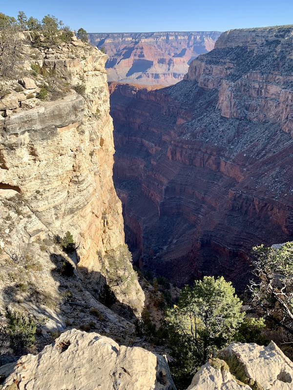
It passes the Abyss, which drops 3300 feet straight down.

If you have a fear of heights (or your legs are too wobbly after so much hiking) you might be best off to stick to the asphalted Greenway. My legs were wobbly, but...

When I hopped a bus at Mohave Point to get back in time to meet Steve and Mom, who should be my driver? The same woman. We both felt like it was a God thing.

Last shot of Grand Canyon. Well, at least for 2021.

Friday, November 5, 2021

Cedar Ridge Trail, Grand Canyon

After watching the sun rise from Yaki Point (previous post), I headed for the Kaibab Trailhead. The bus stops there on the way out, but not on the way back. No trail is marked on the map, but the bus driver (who had told me rather abruptly that I would have to walk) kindly pointed me to a shortcut along the rim, so I wouldn't have to go the long way around by the road.

It was 7:30 when I started down the trail, and the rocks were still rosy with the dawn.


The trail begins with a series of switchbacks.

The place where people are gathered near the center of the picture below is called Oo Ah Point for obvious reasons. I was amazed at how many young families I saw there on my way back up. I'm sure they had to carry the kids back, and they undoubtedly weighed more than my pack.

Here is the view that elicits the oos and ahs.

I had planned to hike 1.5 miles to Cedar Ridge. That doesn't sound like much, but the trail drops 1340 feet. And then, of course, there is the return. From Oo Ah Point I could see the rest stop at Cedar Ridge which looked to be pretty much at the same level as the enticing red butte in the middle of the picture. It's not. It probably took me another hour to descend from Cedar Ridge to the pyramid and return, but it was worth it. I sat in the shade and drank tea and ate cheese and crackers and watched the more ambitious hikers continue toward the bottom.

Then there was the return to the rim...

I had no commitment to meet up with Steve and Mom until supper, so I had plenty of time. The day began with a stocking cap and gloves as well as my jacket. Temps were in the 30s. The floor of the canyon was predicted to reach 90. By the time I reached the rim, the jacket, gloves and cap were stuffed in my backpack, and I had unzipped the legs from my hiking pants so that I was wearing shorts. I stopped at every shady rock. I enjoyed the views, sipped tea or drank water from my camel pack (a backpack with a plastic bag of water and a built in "straw" that reaches around so I can drink without taking the pack off). I readily stepped aside to make way for anyone coming down hill. They thought I was being nice. In fact, I was taking every opportunity for a break.

Stuff does fall from the cliffs.

Mules use this trail. I was happy not to meet any, but there was evidence that they had been there.

I made the rim by noon after 4 and a half hours on the trail. (I took too many tea breaks to claim 4.5 hours of hiking.) After calling Steve to let him know I was back on the surface, I walked the rim trail as far as Mather Point near the visitor center. Then I hopped a bus to transfer to the red route and see the other end of the park--the part that isn't accessible to cars these days.

The buses are handicap accessible, but the depot was too far from the parking for Mom to walk. When I asked the bus driver what he recommended, he told me we could get a code that would allow access for the car to any place the buses went. I hopped off at the next stop and called Steve. He brought Mom, got the code at the entry gate, and met me at Hopi lookout. We continued down the road stopping at every overlook or pull out. Mom got to see lots more without having to leave the car.

But not getting out of the car, is not my thing. So again tomorrow Steve agreed to bring me in to catch the bus west before we left for Phoenix.

Sunrise at Grand Canyon, Yaki Point

Steve brings me to the visitor center shuttle bus depot where I catch the 6:30 AM orange line to Yaki Point. The bus is surprisingly full for the early hour. At 70, I am probably the oldest person present. Most get off at the Kaibab Trailhead. About half a dozen of us continue on, including a gray-haired couple.

When we leave the bus, there is a hushed silence. No one speaks above a whisper. I settle myself on a rock just above this gap in the rim to eat my granola bar, drink my tea, and pray as I wait.

To my left a young woman wears such an expectant expression that I ask her permission to take this.

Someone wanders to a point further east. Others soon follow.

And then the sun begins to touch the peaks.

The light grows. The color spreads. And a new day at Grand Canyon begins.


Thursday, November 4, 2021

Grand Canyon, South Rim


We felt the vastness of the Grand Canyon much more at the South Rim than at the North. It's also more crowded.

We found a picnic spot at an overlook...

...where we enjoyed the incredible view

It's often hard to glimpse the Colorado River so far below. I am amazed at God's patience in carving out this place. I had to pinch myself over and over. I'm really here.

I took a gazillion more pictures, but I won't bore you. Besides, I'll have a gazillion more tomorrow. I have been mentally stringing them all into a movie with instrumental Christian music in the background. That will have to wait until we get home.

We saw elk several times.

We settled Mom in the hotel room a few miles from the rim, and Steve and I returned to Yavapai Point to watch the shadows change as the sun set.

On the schedule for tomorrow? Sunrise and an early morning hike.
 

Cathedral Wash Trail, Marble Canyon, AZ

Cathedral Wash in Marble Canyon, AZ, is undoubtedly the most mentally challenging hike I have ever done. Certainly alone. I have done more physically challenging hikes. (I did not come out of Cathedral Wash with my knees literally shaking like I did after one mountain hike in Korea.) But those hikes were with my son-in-law. Some of them involved ladders or pulling myself up by chains grounded in the rocks, but they were well marked, full of other hikers, and even had tea shops or souvenir stands precariously perched at the top! 

And I was not alone.

Cathedral Wash was a completely natural situation, making my way from the Lee’s Ferry road, down a slot canyon toward the Colorado River. Do not attempt without boots. Or poles. Or if you are afraid of heights.


The sun was just up when I arrived at the pull out for the trail.


The trail begins by cutting under the road.


On the other side of the culvert is a shallow wash.


But it quickly descends. 


I watched for footprints to give me clues as to which way to go, and was always glad when someone had prepared the way.


So which ledge will be most successful in getting me past the water without leaving me too high to get down?


Worth it every step!


The “trail” was 1.2 miles. I gave up at one mile and turned back when I came to the top of this dry waterfall maybe 25- or 30-feet high. There was a way down. I could see a pile of rocks at the bottom that someone had piled up to climb back, but I lacked confidence that I have the upper body strength to do it. And I was alone. Steve knew which trail I was on to look for me if I didn’t come back, but it would be a long wait. I really needed one of those Korean ladders or chains.


On the way back up, I had to remember which ledge had been successful on the way down. (This one is where the no-fear-of-heights warning comes in.)

At this point coming down, I chose to jump because I could see a heap of rocks that someone had piled up to be able to reach high enough to climb back up. On the return I had to reposition some of the rocks that had scattered (probably when the earlier hiker kicked his or her way up.) Even then, I ended up stretching on my stomach and kicking my right leg up to role on my belly while feeling completely overbalanced by the pack on my back.  


 On the way back up, I met a nature photographer coming down. I wish I could see HIS pictures! He had knee-high rubber boots with hiking-boot soles that made me jealous. If you want more images, try this page of images from other hikers although some of them show the Colorado below Lee’s Ferry at the bottom of the canyon, which I never reached.


When I got back to the hotel room, we took off for the Grand Canyon South Rim!