After watching the sun rise from Yaki Point (previous post), I headed for the Kaibab Trailhead. The bus stops there on the way out, but not on the way back. No trail is marked on the map, but the bus driver (who had told me rather abruptly that I would have to walk) kindly pointed me to a shortcut along the rim, so I wouldn't have to go the long way around by the road.
It was 7:30 when I started down the trail, and the rocks were still rosy with the dawn.
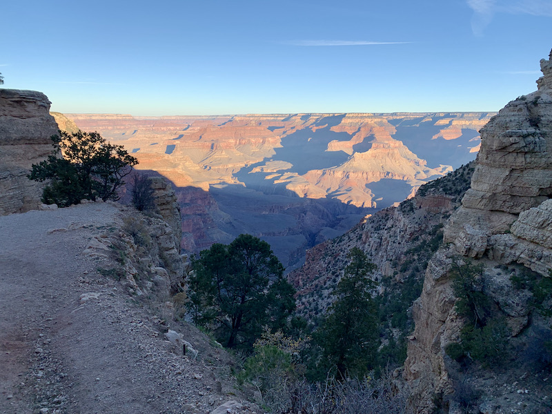


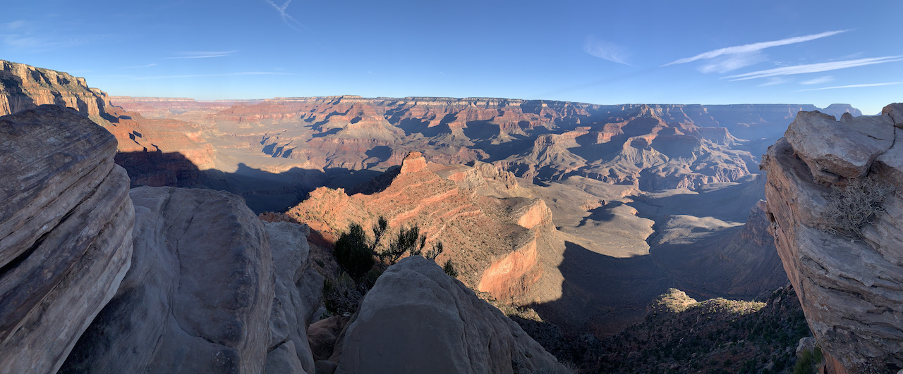
Here is the view that elicits the oos and ahs.
I had planned to hike 1.5 miles to Cedar Ridge. That doesn't sound like much, but the trail drops 1340 feet. And then, of course, there is the return. From Oo Ah Point I could see the rest stop at Cedar Ridge which looked to be pretty much at the same level as the enticing red butte in the middle of the picture. It's not. It probably took me another hour to descend from Cedar Ridge to the pyramid and return, but it was worth it. I sat in the shade and drank tea and ate cheese and crackers and watched the more ambitious hikers continue toward the bottom.

Then there was the return to the rim...
I had no commitment to meet up with Steve and Mom until supper, so I had plenty of time. The day began with a stocking cap and gloves as well as my jacket. Temps were in the 30s. The floor of the canyon was predicted to reach 90. By the time I reached the rim, the jacket, gloves and cap were stuffed in my backpack, and I had unzipped the legs from my hiking pants so that I was wearing shorts. I stopped at every shady rock. I enjoyed the views, sipped tea or drank water from my camel pack (a backpack with a plastic bag of water and a built in "straw" that reaches around so I can drink without taking the pack off). I readily stepped aside to make way for anyone coming down hill. They thought I was being nice. In fact, I was taking every opportunity for a break.
Stuff does fall from the cliffs.


I made the rim by noon after 4 and a half hours on the trail. (I took too many tea breaks to claim 4.5 hours of hiking.) After calling Steve to let him know I was back on the surface, I walked the rim trail as far as Mather Point near the visitor center. Then I hopped a bus to transfer to the red route and see the other end of the park--the part that isn't accessible to cars these days.
The buses are handicap accessible, but the depot was too far from the parking for Mom to walk. When I asked the bus driver what he recommended, he told me we could get a code that would allow access for the car to any place the buses went. I hopped off at the next stop and called Steve. He brought Mom, got the code at the entry gate, and met me at Hopi lookout. We continued down the road stopping at every overlook or pull out. Mom got to see lots more without having to leave the car.
But not getting out of the car, is not my thing. So again tomorrow Steve agreed to bring me in to catch the bus west before we left for Phoenix.
No comments:
Post a Comment